| Flying Site Rules |
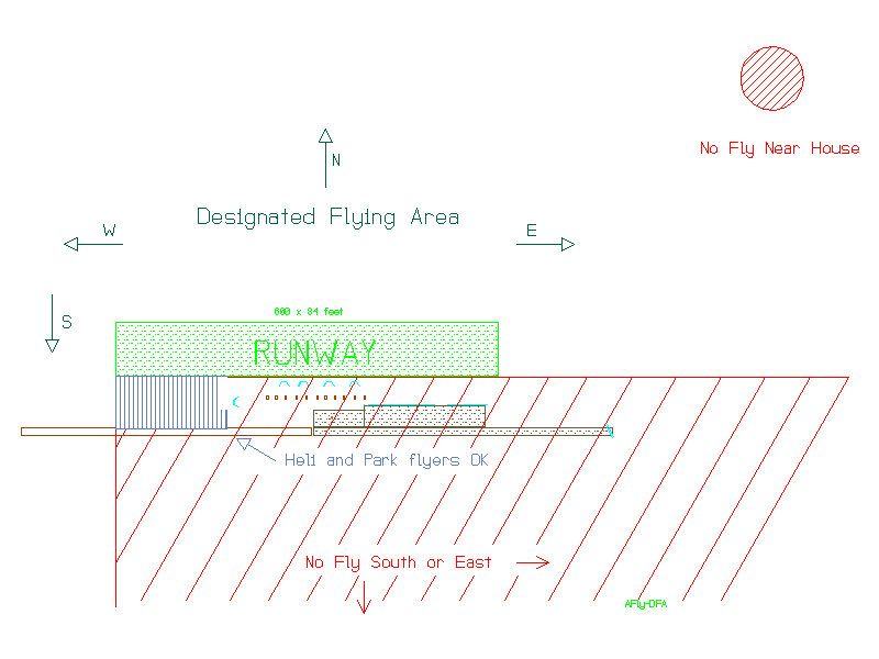
Designated Flying Area |
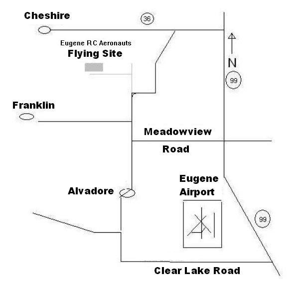
Flying Field Map |
Field
Power |
|
|
EUGENE
RC
AERONAUTS
|
Academy of Model Aeronautics National Model Aircraft Safety Code must be adhered to.
Use of field restricted to ERCA members and guests.
Current ERCA member ID card is required for members and must be visible. Current AMA membership required for guests.
No power flying before 0730.
If not using a 2.4 GHZ transmitter, frequency clips must be used.
All 72 MHZ transmitters must be certified narrow band operation.
Quiet mufflers required on all 2-cycle engines.
No excessive running of engines in the pit area.
No flying over spectator area or pits.
Do not taxi out or into pits. A/C are to be carried to safety and taxi line in front of pilot stations. Big Bird A/C can be taxied off of startup pads but must not be taxied back to pit area.
Smoking allowed only in vehicles.
No pets allowed.
Spectators must remain behind fence unless accompanied by a ERCA member.
WINTER FLYING – During November, December, January and February
On Wednesday, Saturday and Sundays no flying is allowed prior to NOON.
DO NOT ARRIVE AT THE FIELD BEFORE NOON.
In case of an EMERGENCY Call 911
ERCA Flying Field Is at: 92560 Alvadore Rd Junction City, OR 97448
GPS Lat 44°10’44.90″N Lon 123°15’53.87″W
As posted at field 06-29-2013